Clearing the Skies for Emergency Drones: NASA's Priority Access Test
When a police car or fire truck races through traffic with lights flashing, drivers instinctively pull over. But what happens when drones become a common sight in our skies? NASA is working to give emergency drones the same right-of-way that ground vehicles get. In February 2025, a joint exercise in North Texas demonstrated how airspace prioritization tools can allow first responder drones to move swiftly and safely through crowded skies. This effort brings together NASA, the FAA, local public safety agencies, and industry partners to prepare for a future where commercial and emergency drones share the air.
Why do first responder drones need airspace prioritization?
As commercial drone deliveries and other operations become routine, the sky will get crowded. Just as emergency vehicles on the ground rely on sirens and lights to clear a path, public safety drones require a mechanism to safely navigate through busy airspace. Without prioritization, a police drone responding to an active threat or a fire drone racing to a blaze could be delayed by delivery drones following routine flight paths. NASA's tests focus on creating a system where emergency drones can signal their need for priority, prompting other drones to yield. This ensures that life-saving missions are not hindered by air traffic, while still allowing commercial operations to continue smoothly. The goal is to balance safety and efficiency for all users of the airspace.
How did NASA test drone priority in crowded skies?
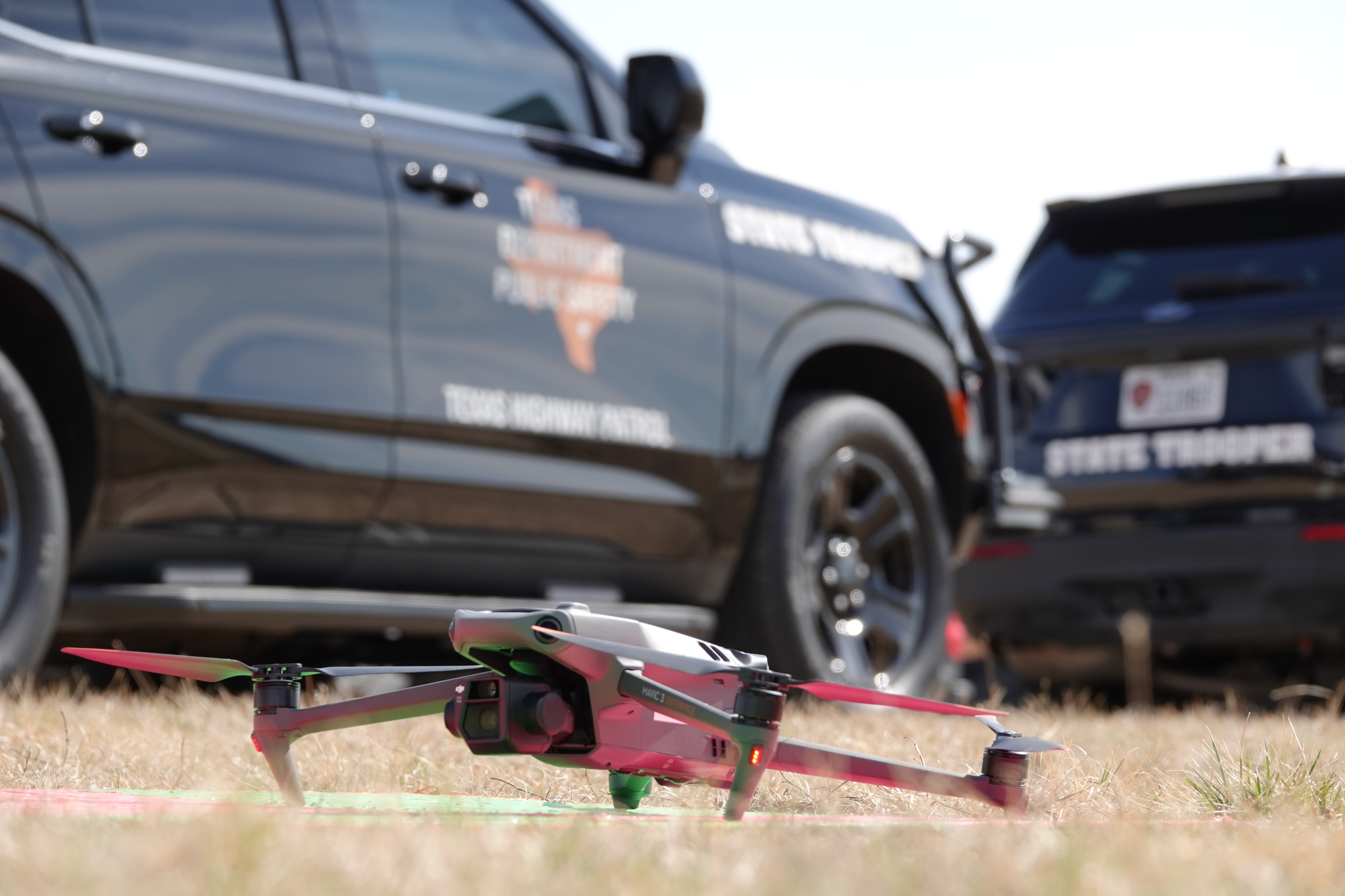
Researchers from NASA's Ames Research Center teamed up with the Texas Department of Public Safety, local emergency services, industry partners, and the FAA for a live flight exercise on February 18 near North Texas. During the test, multiple drones were flown simultaneously, including ones simulating commercial operations. When a police, fire, or rescue drone launched, the other drones automatically moved aside to give way. The system used real-time airspace prioritization tools developed by NASA. In cases where multiple public safety agencies responded to a single simulated emergency, their dispatchers coordinated to determine which drone had the highest priority. The exercise proved that the concept works in a realistic environment.
Who participated in the Texas drone exercise?
The exercise was a collaborative effort involving NASA's Ames Research Center in Silicon Valley, the Texas public safety community (including local police and fire departments), the Texas Department of Public Safety, the Federal Aviation Administration (FAA), and several industry partners. North Texas was chosen because it is an FAA-designated region where commercial drone deliveries already happen daily. This real-world backdrop allowed researchers to test priority tools against actual commercial drone traffic. The partnership ensured that all perspectives—regulatory, operational, and technological—were represented, making the test results more applicable to future nationwide implementation.
What happens when a public safety drone takes off in the test?
When a police, fire, or rescue drone launched during the exercise, other nearby drones automatically shifted their flight paths to clear space. This was not a manual rerouting; the airspace management system detected the emergency drone's status and issued commands to other drones to move aside—similar to how autonomous vehicles might coordinate. In scenarios where multiple emergency agencies launched drones simultaneously, their communication systems prioritized the most critical mission. For example, a drone from a fire department heading to a structure fire would get precedence over a police surveillance drone monitoring a non-violent incident. The system balances urgent needs while keeping the sky safe.

How do public safety drone missions differ from commercial drone flights?
Commercial drone flights typically follow predictable, pre-planned routes—like a delivery from a warehouse to a customer's doorstep. Public safety missions, however, are anything but predictable. A police drone chasing a suspect might need to turn suddenly; a search-and-rescue drone might switch direction based on new sightings; a fire drone might need to circle a dangerous area. These unpredictable movements create challenges for conventional air traffic management, which assumes steady paths. During the Texas test, researchers simulated this by having a drone follow an SUV driving erratically (mimicking a fleeing suspect). The system successfully adjusted other drone traffic in real-time, showing that public safety drones can operate safely even with abrupt maneuvers.
What data did researchers collect during the exercise?
The team gathered data on how unpredictable movements of a public safety drone affect surrounding commercial drone operations. They measured reaction times, distance buffers, and communication delays when a drone changed direction suddenly. The erratic SUV simulation demonstrated that nearby commercial drones could be redirected quickly without collisions. Researchers also collected metrics on airspace capacity and the impact of multiple priority requests. This data is critical for refining NASA's air traffic management algorithms and for developing standards that the FAA can use. The exercise validated that the tools are ready for more advanced testing and eventual integration into national airspace systems.
What are the next steps for drone priority systems?
This Texas test is one of many steps toward a future where drones coexist safely. NASA plans to use the data to improve its traffic management frameworks, working closely with the FAA and industry partners. The ultimate goal is to build a scalable system that can handle thousands of drone flights daily while automatically giving priority to emergency missions. As commercial drone use grows, public safety operators will need assured access to airspace without delays. The success of this exercise brings that vision closer, ensuring that the sky—like the road—makes way when lives are at stake. "The key is to prioritize safety of flight operations while balancing the efficient use of airspace for all operators," said Abhay Borade, NASA research lead.
Related Articles
- Pentagon Releases 162 UFO Files on New Government Portal; Most Remain Heavily Redacted
- 10 Key Insights into Sakana AI's KAME: Redefining Real-Time Conversational AI
- The Power of Deliberation: Why Giving AI Models More 'Thinking Time' Improves Reasoning
- VECT Ransomware's Critical Flaw: How a Nonce Mistake Turns Encryption into Data Destruction
- KAME: Sakana AI’s Tandem Speech-to-Speech Architecture Combines Speed and Knowledge
- Accelerated Immune Cell Aging: A New Blood Test for Early Depression Detection
- How to Determine Your Optimal Protein Intake – A Step-by-Step Guide
- Space Force Reveals Golden Dome Interceptor Partners Amid Rocket Launch Calendar